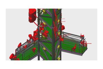
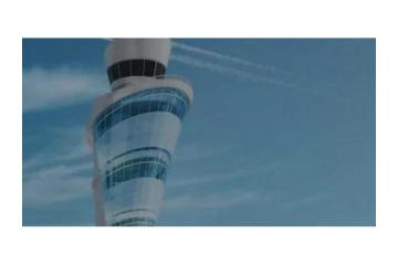
Measuring buildings and infrastructure takes time. AUAV uses terrestrial laser scanning to do it faster. The scanners capture exact 3D shapes and surfaces. It’s useful for planning, design, and inspections. Visit auav.com.au or call 1300 738 521 to learn more. Email: [email protected].
Read morePublished on February 23, 2026


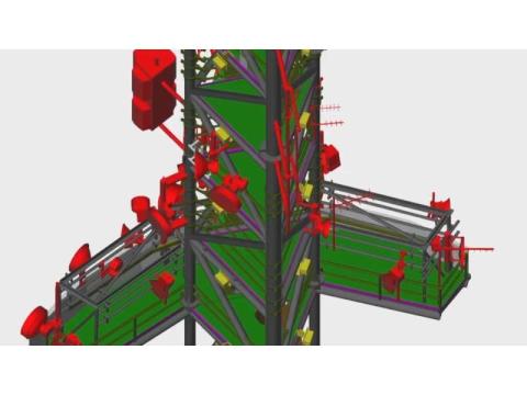
Measuring buildings and infrastructure takes time. AUAV uses terrestrial laser scanning to do it faster. The scanners capture exact 3D shapes and surfaces. It’s useful for planning, design, and inspections. Visit auav.com.au or call 1300 738 521 to learn more. Email: [email protected].

 Peter Dreyer Photography
Today 13:25
Peter Dreyer Photography
Today 13:25
 Oscorm Digital
Today 07:57
Oscorm Digital
Today 07:57
 Independence Bunting and Flag Corp
Today 07:51
Independence Bunting and Flag Corp
Today 07:51

 Sanctum Dive Resort
Today 07:25
Sanctum Dive Resort
Today 07:25

 Pro
NGD Technolab LLP
Today 07:19
Pro
NGD Technolab LLP
Today 07:19
 Wood Talk Furniture
Today 07:07
Wood Talk Furniture
Today 07:07

 Set Square Surveyors
Today 07:02
Set Square Surveyors
Today 07:02
 Himani
Today 06:23
Himani
Today 06:23
 Seodigiteam
Today 06:21
Seodigiteam
Today 06:21
 Lakeland Landscaping
Today 06:14
Lakeland Landscaping
Today 06:14

 Pro
Ramcko Machinery
Today 06:03
Pro
Ramcko Machinery
Today 06:03
 Amiry Enterprises PTY LTD
Today 05:55
Amiry Enterprises PTY LTD
Today 05:55
 kiarapatel705
Today 05:51
kiarapatel705
Today 05:51
 Growing Pro Technologies
Today 05:46
Growing Pro Technologies
Today 05:46

 SISGAIN
Today 05:28
SISGAIN
Today 05:28
 Sona Chauhan
Today 05:24
Sona Chauhan
Today 05:24
 jameshat
Today 05:17
jameshat
Today 05:17

 Daros Security System
Today 05:16
Daros Security System
Today 05:16

 Pro
Moov Logistics
Today 05:02
Pro
Moov Logistics
Today 05:02
 Pro
thematrixsolutions
Today 05:00
Pro
thematrixsolutions
Today 05:00

 Pro
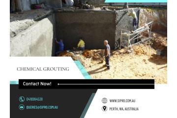
Sipro Management Pty Ltd
Today 04:32
Pro
Sipro Management Pty Ltd
Today 04:32
 Pro
Moov Logistics
Today 04:25
Pro
Moov Logistics
Today 04:25
 SISGAIN
Today 04:12
SISGAIN
Today 04:12

 Flying Dove Tours Travel Limited
Today 04:04
Flying Dove Tours Travel Limited
Today 04:04